The Iberia Parish Office of Homeland Security & Emergency Preparedness is monitoring two upcoming weather shifts for our area. Please stay weather-aware over the next 48 hours.
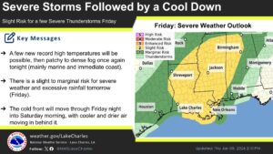
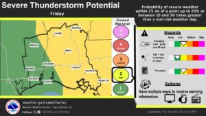
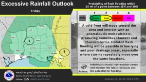
Friday: Severe Weather & Rainfall Risk The National Weather Service in Lake Charles has placed our region under a slight to marginal risk for severe weather tomorrow.
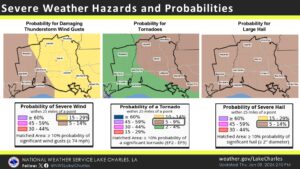
- Main Threat: Strong, damaging winds (15–29% probability).
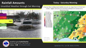
- Rainfall: Potential for excessive rain in short periods.
- Tornado/Hail: These risks remain low (2–4% for tornadoes, 5–14% for hail), but we urge residents to remain vigilant.
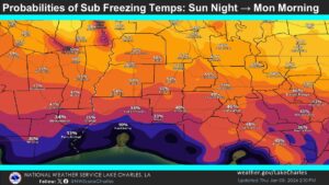
The Weekend: Cold Air Surge A cold front will sweep through Friday night into Saturday morning, clearing out the rain and ushering in a much colder, drier air mass.
- Temperature Drop: Expect a significant cool-down starting Saturday.
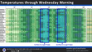
- Freezing Temps: While areas north of Hwy 190 may see a light freeze Monday and Tuesday mornings, Iberia Parish is currently forecast to hover just above the freezing mark.
What you should do:
- Secure loose outdoor holiday decorations or furniture before Friday’s wind arrives.
- Have a way to receive weather alerts throughout the day on Friday.
- Prepare to protect sensitive plants and outdoor pets as temperatures drop toward early next week.
Stay tuned for further updates as the front approaches.
National Weather Service Lake Charles
NWS Lake Charles Facebook Page
For more information contact: Brandon Migues


Recent News
Press Release: David J. Berard Rd & Cornelius P. Voorhies Rd
From Iberia Parish President M. Larry Richard -
Iberia Parish Rabies Control Groundbreaking Ceremony
From Iberia Parish President M. Larry Richard -
Brenda & Phyllis Dr Roadwork
From Iberia Parish President M. Larry Richard -